Sahir Permall finds that Somaliland is so much more than what’s on the map
You’re going WHERE?’
It was a surprisingly difficult question to answer, given that I had just planned an itinerary for a week’s visit. Somaliland lies somewhere in the Horn of Africa, only 20 miles from Yemen at the narrowest point across the Gulf of Aden. Somaliland has a democratically elected government and its own currency, flag and security forces. A former British protectorate, it declared independence from neighbouring Somalia in 1991, and has governed itself peacefully ever since. Yet Somaliland isn’t internationally recognised as a country by anyone other than Israel (and even that only as of December 2025).
The question turned out to be a useful lesson in how much truth maps – both official and the mental maps we create to understand the world and our place in it – can leave out.
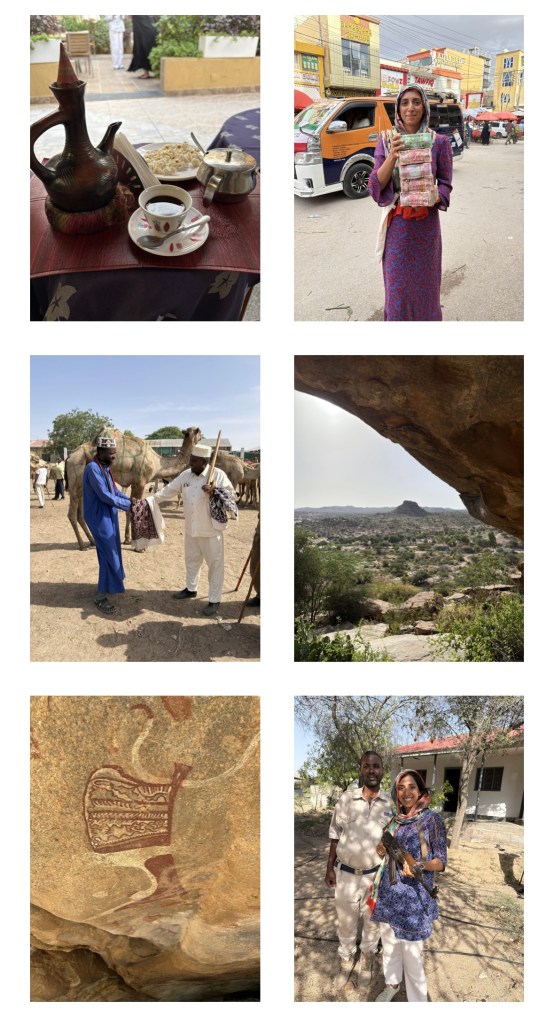
Landing in the capital, one of my first stops was the livestock market. One of the mainstays of Somaliland’s stunted economy, livestock accounts for up to 85% of export earnings, and in Hargeisa’s market that wasn’t an abstract statistic. Goats, sheep and camels were present en masse, being inspected, haggled over, bought, sold and prepared for the journey towards the port of Berbera and the Gulf countries beyond.
I was there in the run up to Eid, where animals are ritually sacrificed, and so the market was at its busiest. A place of thriving business, of dust, bleats and pungency; there wasn’t another tourist in sight. I drank camel milk tea (rich, creamy and delicious) and took a photograph of the veiled woman expertly pouring it, who loudly objected. I immediately deleted it and apologised, chastened and reminded that there is a difference between being welcomed into a place and feeling entitled to extract from it.
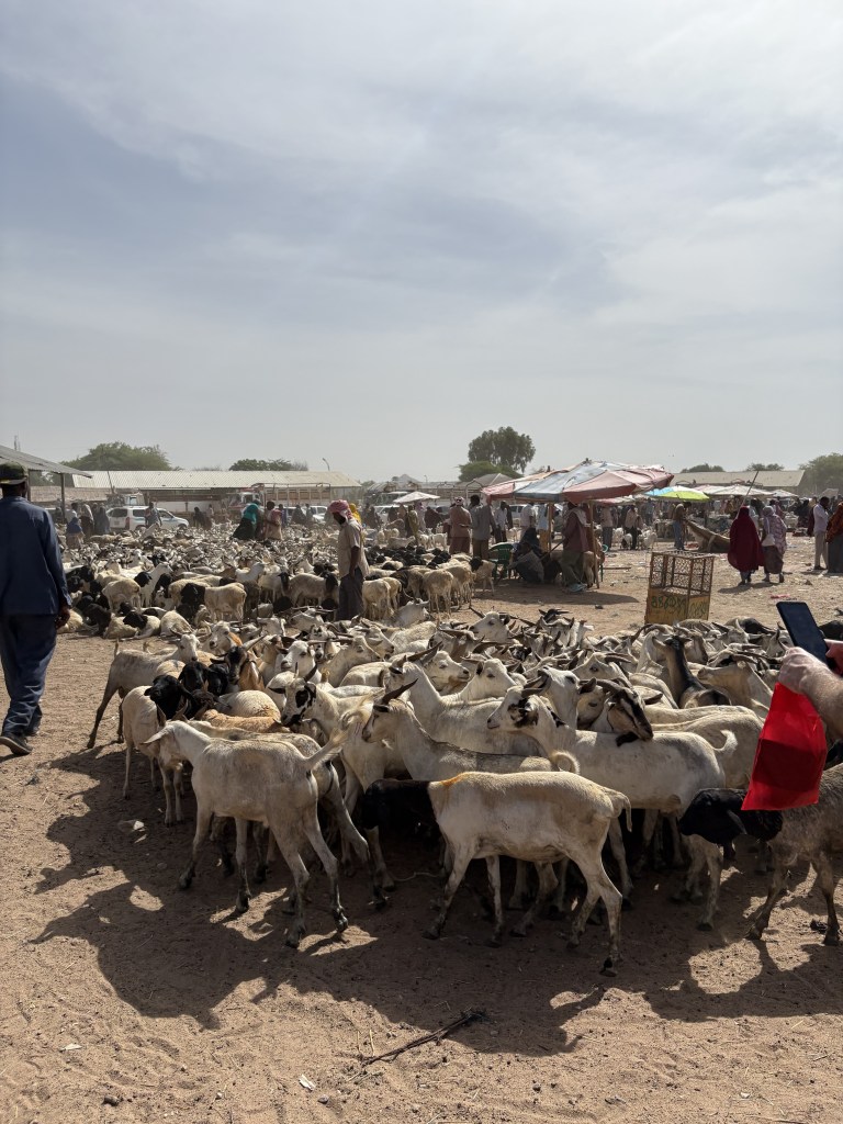
The market was also my first sense that Somaliland doesn’t exist in complete isolation from the rest of the world. There was trade, money, movement and an obvious connection to the Gulf. And there was a surprising amount of infrastructure, good restaurants and rather smart hotels in a place that receives so few tourists. It was only when I heard an apparent Somalilander speak to his friend in a strong Welsh accent that I realised this infrastructure is catering for Somaliland’s large diaspora. People who have made their lives in Europe, North America and the Gulf come back to visit family, invest, eat well and spend money. A number of international NGOs also operate in the country: Somaliland may not have a conventional tourism industry, but it has no shortage of people accustomed to one.
The strange thing about travelling somewhere described as ‘off the tourist map’ is that it tells you almost nothing about what the place is actually like – how people live, what drives it, or how connected it might be to the rest of the world.
From Hargeisa, we – I was accompanied by a driver, guide and the legally mandated armed police escort for any foreigner leaving the capital – ventured inland, where the landscape changes dramatically: hotter, more arid, rocky and desolate. We headed for the ancient site of Laas Geel, which translates as ‘camel watering place’.
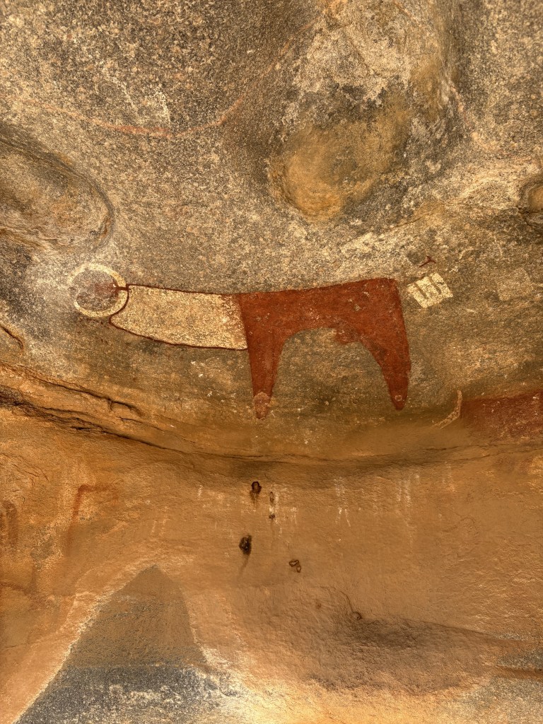
This network of caves, reached by climbing up from the plateau after a bumpy drive across it, contain rock paintings dating back to between 5 and 10,000 years ago. There were cattle, people and other animals picked out in astonishingly vivid reds, whites and ochres. The site only came to the attention of the international archaeological community after a French team documented it in 2002.
What I found most fascinating was how recognisable some of it was. The cattle are unmistakably cattle: beautifully rendered with distinctive markings. The view across the plateau seemed unchanged, other than the dried-up river bed. Yet almost everything else about the lives of the people who painted them has disappeared. We don’t know what they called themselves, what language they spoke or what stories lay behind the paintings. It felt like an unusually direct encounter with people who lived impossibly long ago.
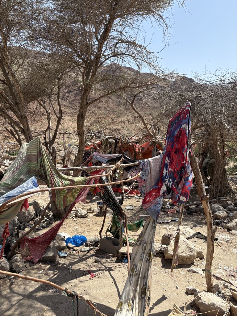
Later, we drove to Biyo-Kulule, a set of hot springs reached by a particularly brutal stretch of desert track. Eventually we abandoned the 4×4 beside a river when we got stuck in the mud and walked the rest of the way through the naturally warm water. There was no visitor centre, no sign explaining what we were looking at and nobody else there. Instead, there were just tents, temporary shelters and odd bits of plastic dotted around the springs. The guide explained that nomadic families live there during the cooler months and move on again when the seasons change. It was both a natural attraction and the seasonal home to a nomadic people.
By this point, the Somaliland I had arrived expecting had become difficult to find. I had imagined remoteness and found trade. I had imagined a place with little connection to the outside world and found a diaspora connecting continents. I had imagined empty desert and found evidence of people moving through it, living in it and returning to it. And at Laas Geel, the supposedly obscure corner of the map contained some of the most remarkable evidence of creative human life I had seen anywhere.
Perhaps that is what stayed with me most. A map is useful, but it is also ruthless. It reduces complicated histories and living places to a flat representation, and sometimes the things that fall between those lines are the things worth going to see.
I went to Somaliland because it was somewhere I knew almost nothing about. I came home wondering how many other places I have never really seen simply because they were never properly on my map.
This article was first published in Globe, the Globetrotters Club Magazine, in October 2026. I used the company 379 Degrees Travel to source guides and support with the itinerary. Please find them here: https://379degreestravel.com/

